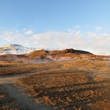
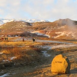
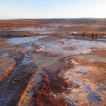
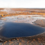
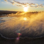
Continuing along the Icelandic Route 1 ring road, a short drive from the majestic Gullfoss waterfalls brings you to the Geysers hot spring park. The word “Geyser” originates from the Icelandic word “Geysir”. It is used in almost all mainstream languages worldwide, including English. The presence of wide open flat grounds littered with spewing steam signifies your arrival at the Geyser park. Here, you can check out various geothermal sources native volcanic active surfaces of the earth, such as hot springs native to Iceland here for instance.
Iceland is one of the most volcanic places on earth. About 130 active and extinct volcanic mountains calling home to the Icelandic land masses, residing in locations above and underwater. These volcanoes were responsible for the formation and existence of the island in the first place. The Icelandic island is divided in two by main volcanoes of which 18 have been observed to have erupted from 900 AD since the first Viking settlers came on the island.
One of the most notable volcanoes of course will be the eruption of Eyjafjallajökull in 2010, its name means “the glacier of Eyjafjöll” in Icelandic. You can recall it given the amount of disruption it caused with aviation industry with the grounding of aircraft from its large volcanic ash plume formed during its eruption phases.
Panorama of the Geysir park
Icelandic Geysirs!
Having said that, volcanic activity are the primary means for the formation of this geothermal park. The park is an open and simple tourist attraction, with its own nearby visitor center and gift shop in the vicinity built not too far off an open parking and drop off area. A short walk through a guided route bounded by rope handrails bringing you around various points of interest in the Geothermal park itself.
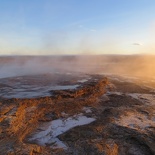
The park is theming with subterranean activity brewing out from the ground. It is not everywhere in the world where you are able to find superheated water seeping their way through the layers of earth crust and erupting on the surface. Here you get to see various hot springs and naturally superheated (and at times boiling) water features sprouting everywhere from the ground.
These volcanic features, both large and small often pretty much give away their positions by emitting lots of smoking steam ranging from a scalding 80 to 100 degrees celsius. These features form mini-cloud through rapid-cooling (condensation) relative to the freezing ambient temperatures of the Icelandic winter, resulting in a rather surreal alien landscape of emitting steam.
The site itself is easy to walk though; you may come across mini streams and ponds which you can simply hop over. Besides the presence of a few hilly elements, the park itself is largely flat in terrain with all major points of interest wheelchair accessible. You can at times climb up small paths out of the guide ways to get up and close to few of the many hot springs on the site. Just avoid touching or drinking them as they may contain traces of ancient bacterial which could be nasty.
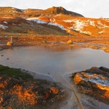
A heavy, but otherwise non- obtrusive smell of sulphur (rotten egg smell) lingers in the whole area, typical of the abundance of mineral-rich ground water. Interesting features here include boiling pools of heated ground water sipping out on the surface, contained by craters of all sizes, some as large to fit a medium-sized car. Just be sure not to fall in or you will be in for a very bad day!
There were also hot spring pools too with overflowing banks on a highland portion of the park, which literally oozed hot boiling water down its banks flowing all over into the low lying areas. Due to the high sulphur content of the ground water, you can easily trace the origins of the flow from the prominent white dried-up sulphur tracks left behind as the water flow cooled. Some craters are overflowing so quickly that they form multiple warm mini rapids through the various terrain features in the park. The flowing water is warm enough to touch by hand.
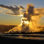
Stroaofoss Geysir
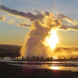
The main attraction here will be geyser, Stroaofoss. It erupts every 10 minutes or so in a spectacular display of high pressure steam jetted up to over 10 meters into the air, disappearing into a midst of vaporized water and the process repeats. Visitors like myself often get mesmerized looking at the origin of the Geysir blast- a large bowl-like hole swishing with steaming water, only to be thrown back by a large blow-off of water which cools almost immediately into the surroundings when it erupts.
Occasionally, you can get double or even triple-stacked eruption with consecutive eruptions which will often catch you unexpectedly. I can guess this could caused by different compartments in the geyser releasing their internal pressure in waves, adding to a staggered eruption when the first load fires. This proved rather challenging to the number of photographers seen camping by the sides of Stroaofoss, hoping to capture the biggest part of the staggered eruption, only to be caught off-guard by a secondary let off of more hot steam. The geysers here erupt throughout the year independent of the seasons and often never fail to impress with their regular blowing of their tops, literally.
The Althingi and World longest fault line at Þingvellir
Moving from the Gesir park is our last trek of the golden circle is the world oldest parliament (The Althingi) as well as a spectacular continental fault line at Þingvellir National Park. Even after Iceland’s union with Norway in 1262, the Althing which is a small row of little huts still held its sessions at Þingvellir until 1800 until moving to Reykjavík.
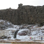
The fault line is an odd big chunk of rock jutting abruptly from the ground, forming a sudden change in elevation between two land masses via a cliff-like and gorge-like vertical face. The fault line also separates the Eurasian continent plate to that of the North American plate. Laughably at any point of time you can jump between Europe and America here, despite residing in the same country. This fault line runs deep in the Atlantic ridge and strangely popping up steeply up in the middle of sea bed- pretty much the story of how the island of Iceland was formed.
On closer examination of the jutting rock face, you can make out the different coloured layers of rock, almost like a layered cake formed over millions of years. Each layer tells you much of the geology origins; you are able to deduce the historical topography and nature of life at any given time from studying the composition of the rocks.
There is a visitor information center serving the National Park, situated near the camping ground which is a popular spot in the summer. Routes to the various park hiking trials also originate from this information center. In the warmer summer months, waterfalls can be seen delivering highland glacier melts in great ferocity from the cliff faces, feeding the lakes downstream.
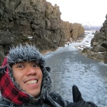
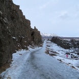
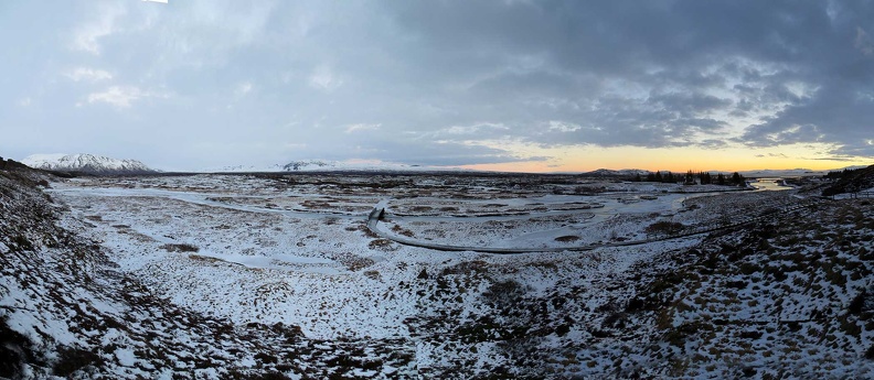
The National park is largely flat with minimal changes in elevation or high spots. In the winter, the entire area is blanketed by a cover of white, offering really nice open views of the Icelandic Tundra. It can get rather windy and chilly out here in the vast openness. Lakes and streams are mostly frozen as well, with ice-frozen rocky pathways at times providing for more a challenging trek through the park in winter.
Þingvellir and Silfras
As previously introduced, Iceland’s volcanology includes a high concentration of active volcanoes. Due to Iceland’s location on the mid-Atlantic Ridge, a divergent tectonic plate boundary exists. This fault line is most highly visible and spectacularly pronounced here at the Þingvellir National park, given its location over this tectonic hot spot. This fault lines carriers on into the horizon before disappearing into lake Silfras, as runs through the middle of the entire island of Iceland.
Panorama of the Þingvellir National Park fault line World longest parliament
Þingvellir National Park is also home to a variety of lakes such as Silfras- a fissure between the continents. Silfras is a popular spot for scuba diving and snorkeling. The lake was formed by the accumulation of melt from the park’s surrounding glaciers. It is rated to be one of the top 3 dive sites in the world, as you can literally dive in crystal-clear drinkable water (tastes like Evian mineral water) between two vertical tectonic gorge-like faces, a remarkable experience.
The Icelandic geological features, (from an earthquake perspective) here are somewhat more stable from a geographical perspective compared to other faultiness lines, like those in San Andreas in California or in Japan for instance. While the Icelandic plates move apart from each other, the California and Japanese continental plates along the Pacific ring of fire dig under each other. This more evasive tectonic plate movement of the earth’s crust will tend to result in more rock stresses, as one plate is usually forced or crumpled under another. This accumulation of stresses may be suddenly released over build-up of years or centuries, resulting in earthquakes.
Having the Icelandic plates moving apart from each other has it benefits from a land mass perspective. Due to the large amount of tectonic activity the island gets, the island about 3 times the size of Singapore actually grows apart at a rate of 2cm a year. With new rock constantly forming from the center of the island in Þingvellir, much of the younger part of the island situated right here at this fault line as the two plates here diverge. Adding on that, the oldest parts of the Icelandic island can be found on the island edges and coast lines. These coastal rocks date back about 20 million years, which is relatively young from a geological perspective with respect to the age of our planet.
Panorama of Þingvellir scenery
Leaving Þingvellir behind, my Icelandic golden circle adventure ended as the sun sets over the Atlantic horizon as I journey back to Reykjavik before sunset and in time for dinner and to chill out the rest of the night.
It was indeed sure a very nature packed day and one you should not ever miss during your visit to Iceland.

