Canopy walk
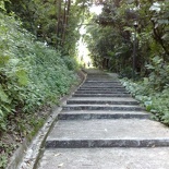
Coming from Hortpark, will bring you along the path to the next line of attraction of this park connector- The tree top canopy walk. The name itself should suggest a bit or two on your following route up to the attraction, involving quite alot of climbing from the bottom of Kent Ridge hill, leading up to Kent ridge park. You should be about 2 1/2 hours into your walk since Mt Faber and would have completed about half of the 9km southern ridge route by here. There is still quite a long way from here.
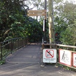
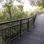
The canopy walk actually sits on the north facing side of the hill facing roughly north east, which the span of the walkway runs perpendicularly from. The design of the walkway takes full advantage of the natural vegetation and topography of the site, constructed on tubular steel supports anchored to various sloping relief areas of the hill. with wooden floor which bear quite a resemblance to the Macritchie and Pasir-ris park mangrove walk platforms which can be accessed from the walkway access upon cresting the hill, that too provided after you’ve climbed up to the top of the hill.
Personally speaking, there is nothing really great about the tree-top canopy walk, true you get to walk with mature greenery all round you, but the path itself is a short blunty 280m which links Kent Ridge Park to the museum Reflections of Bukit Chandu- something which can’t really justify itself as an attraction in comparison to the Henderson arch or forest walk which dwarfs it completely. The “Reflections” museum itself is accessible to the public, especially the elderly and disabled, but not the canopy walk if you are coming from Hortpark. The walkway don’t sound as scenic as it sounds and don’t really offer any fresh new views of the area, it’s only the face of the vegetated hill behind you even the observation decks are obscured by the crowns of the trees in the area.This don’t seem to justify the need to climb to the top for the walk itself. see sunbirds, doves, squirrels, lizards, and white-crested laughing thrushes. There are regular signages along the route similar to those found on the Telok Blangah hill forest walk, that provide educational information on the various plants at the park, there is also a shelter for visitors to take a short break.
Kent Ridge Park
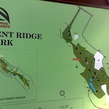
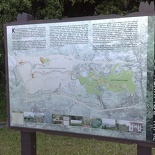
Kent ridge park is very much the park as it always be, surrounding immediate vegetation are mostly secondary forests, which dominates the most natural vegetation on the hill, with groves of Dillenias, Acacias and Tembusu species. You will be told of all these species on the various informational stands lined along the paths. You can also hear the sounds and buzzes of birds and insects breaking the silence and serenity of the park, which in strack comparison is not as frequented by people in contrast to the other attractions.
Kent Ridge park is now mainly frequented by people who intend to drop by to Hortpark, free parking is available at the hill top carparks and a short walk down the hill will allow you to enjoy the highlights. Like Mt Faber and Labrador park, this park are also one of the few with a looming war torn part- One of the few last battles in Singapore was fought on Kent Ridge which dominated the harbour and the British military depots around the Ayer Rajah area. This park is part of the Army’s adoption of tthe Army Green Park with two decommissioned M114 Artillery Guns and an AMX-13 Light Tank are displayed in the park reminding visitors of it’s history. There is even a plaque was installed near Carpark B in the commemorative 50th Anniversary of the end of World War II.
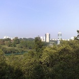
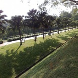
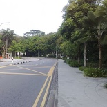
The best views from park will definitely be past the around the Kent Ridge carpark area on the long straight slined by palm trees, on the other hand various look-out points offer visitors magnificent views of the off-shore islands like Pulau Duran Darat.
There are quite a number of fitness stations (about 20) lined all along Kent Ridge Park, so if you are a fitness enthusiast this is the place to be. After going through the park, I can label the park as one more quiet ones in the southern route- More for those who prefer and appreciate serenity and lack of crowds. You can stroll through the area and enjoy the peaceful ambiance away from the hustle and bustle of city living. Nature groups will enjoy the nature trail located near Carpark A, with some rather interesting tropical plants such as pitcher plants and wild orchids littered along this trail. Here you will have the option of the main tarmac route or the off road dirt trail specially made for mountain biking or trekking. Taking the meandering tarmac route down to the park will bring you to the main water features of the park- Two ponds can be found at the foot of the ridge located on the eastern side of the park. This natural pond is home to some turtles and Japanese koi just to name afew.
Kent ridge heritage trail
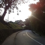
Kent ridge heritage trail is a short walk past the pond area from Kent Ridge park itself, thereafter comes the “rubbish part” of the trek having you to walk right into the urban confines of Science Park I itself. Noticeably are the imprinted leaves patterns on the pathways lined throughout Science park I. You can even chance upon few drink machines dispensing soft drinks at 40 cents a cup for a thirst quencher if may. You have to cross South Buona Vista road (The road from the university flyover) over to the slip route behind NUH before coming right to Prince George Park road which will point your on towards Kent ridge road, a sign there will greet you at the start of Kent ridge road leading into NUS.
The Heritage trail is not exactly a trial but rather a hilly road running along the upper ridges of Ken Ridge hill itself, passing through few NUS research facilitates and dormitories. Throughout the trail you can encounter several small rows of linkways and flights of staircases connecting the route to NUH or the various Tertiary facilitates around the area such as the Temasek life sciences laboratories and the institute for mathematical sciences. The road is completely quiet and empty and I did not even encounter any vehicles throughout the whole route at all, a strack contrast to the bussles of the earlier Mt Faber road. You will pass by a marine research facility before a PUB walkworks facility . The route will terminate right in the NUS campus itself, near the Campus central library where you have to walk from the Kent Ridge Crescent past the computer center before meeting and crossing Clementi road where a short climb of the hill will bring us to our next park just before the Japanese supplementary school.
Clementi Woods
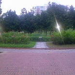
Clementi woods is a small park situated between West Coast road and Clementi road, it runs parallel along West Coast Road itself. It’s also quite an old park with it’s design and layout more of less untouched for almost 20 years, spotting a rather old school red-tiled pavement which runs throughout the park. Despite it being a Saturday, the park is living in the shadow of it’s formal self, completely empty and neglected of park visitors. The park itself used to be situated in a mangrove swamp area, before surrounding neighborhood got reclaimed and developed, therefore still spotting some mangrove plants in certain areas of the park, which all seem to go quite out of place now.
Many of the old playgrounds I remember of there are all now replaced by rather common simple modern fitness corners. There are few small shelter huts lined along the park together with a park restaurant on the top of the hill. The park is ok for runners who do not demand much of a distance to jog. The hills which the park is built on is home to some rather nice long flights of steps for hill training especially strengthening muscles required for static jumps such as standing board jumps. Otherwise, you can (like most runners) use this park as part of their planned running route and not a specific training ground itself given the rather conducive running areas within the neighborhood. For bikes, few parts of the route are out of bounds for cyclists because of runnings steps, unless you don’t mind demounting and pushing your bike up the slopes. It will be quite a pain to rollerblade in this park as well given the uneven and pothole laden brick walkway. No wonder this park is not so friendly as a whole after all.
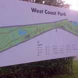
West coast park
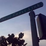
West coast park, just like Clementi woods both have their relatively long past since they were all introduced as parks to complement the residents living in the first few western HDB projects around the area. However, west coast park is presently received rather differently from the public- The place is a direct contrast to the emptiness of Clementi woods. Crossing West Coast Road and making your way along West Coast Link towards West Coast Highway will bring us to this last and final stretch of the 9km southern park ridges connector walk.
West Coast park is very unlike the old park it was before, since then it had almost it’s entire coastline destroyed by the introduction of the new west side Harbour drive and the Pasir Panjang terminal container ports. I still remember the old days when I frequented the area when I was a kid- a large bright open park with children playgrounds glittering in the windy seaside park with rolling sandy beaches lined all along it’s side along West Coast Highway (where you can build seaside sandcastles and pick lots of seashells). There was a lagoon area together with few fishermen huts and sampans lined along the beaches, a walk further into the park will be a shaded turtle pond area shaded and covered by large tall mature fir-looking trees efforts. The park was very much left desolated after the construction of the container ports, where only a few years after where plans and construction work done up to rebuild the area into the current West coast park it is today, still utilizing much of the old relief, vegetation and pond water features.
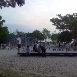
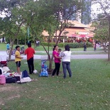
Now west coast park is alive and bustling as a weekend family outing park. Spotting large sandpit playgrounds and picnic areas, if the always full carpark weekends don’t give you a clue of how popular it is, then the packed playgrounds and picnic fields might give into you how frequented the place is now, so that’s where everyone in the west are now!
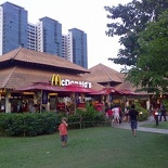
West coast park was built on reclaimed land, so the relief s pretty much flat- ideal for bicycles and roller blading activities alike. The crowds near the carpark and playground area might be a turn off for runners who have to constantly put up with pedestrians and cyclists, so maybe running further inside the park may be more of your cup of tea. The park also spots their own Macdonald’s restaurant and dog run area as well.
Final Verdict- Wonderful! but forgot everything beyond Kent Ridge Park
West coast park is the last and final park, concluding the southern ridges park connector review I have so far. It was definitely an interesting 9km and running from Mt Faber all the way to West Coast park. However, in all what I can say that the highlights of the route will mainly be the Henderson Waves, Forest walk, Arch and Hortpark, ending at most the treetop Canopy Walk at Kent Ridge Park. After that, everything is almost rubbish- The route after Canopy walk will see you through major roads and built up areas.
Even though if you have ground knowledge of the area, it won’t provide the full park-connector experience with nature, having to suddenly find yourself with office buildings (e.g science park) and main roads with no clear signage or debarkation to proceed on next in the route. This problem plagues many park connectors all round Singapore as well.
Given that, you can start off from Telok Blangah hill making your way to Kent Ridge (and vice versa) which will keep you busy with uninterrupted with nature for about 3 hours, thereafter you can take bus service 175 back to where you’ve started, the bus serves between Pasir-Panjang to Depot road allowing you to recap the attractions you’ve walked on the way (as it actually passes by few of the connector route on the way back). Do note you can also take the same service 175 from West coast highway (opposite west coast park) if you were to follow the whole route to the end as well. If you are driving, you can park at either Mt faber park or Kent Ridge park where parking is free and you can make your way from either end and back.
The southern park connector is not only a big jump in the efforts of beatifying and bringing up Horticulture in Singapore, but putting Singapore further into labeling itself as a garden city. if only where the links between the parks be more seamless where the dream and ideology of an island-wide park connector will become a reality.
(You are currently viewing page 3/3)
- Page 1/3 » Henderson wave, Arch, Hortpark, Canopy walk
- Page 2/3 » Forest walk, The Alexandra Arch & Hyderabad Road’s Hort Park
- Page 3/3 » Canopy Walk, Kent Ridge Trail, Clementi Woods & West Coast Park
:: Southern Ridges Full Photo Gallery :: Running Route Article Index Page ::


😛 Thanks Shaun for the very detailed description of the Southern Ridges walk! Much better than the NP website or the Singapore Tourism Board site. My 11-year old son and I did the walk from the Marang Trail up to Reflections at Bukit Chandu in June which we enjoyed thoroughly. We were thinking of repeating that tomorrow but going all the way to West Coast Park. Based on your account, I think we will not bother with Kent Ridge park. You just saved us a rather boring 2 hour walk.
Hi Chin!
Yup the highlight of the walk will mainly be from Mt Faber to Hort park, I guess that is what most people will actually be. You will notice upon hitting kent ridge- it just suddenly turns quiet and deserted, a stark contrast to the newer attractions.
Glad you enjoyed the review!
🙂
browsing and looking through NP and Uniquely Singapore website about this Southern Ridge walk guide.
then bounce to your blog through google. it’s a great guide Shaun, planning to have a fun walk with my church friends, all the NP have is just map of the southern ridge with no narative guide.
really glad that you comes up with it …IT’S GREAT!
thanks a lot, Shaun…from me and my friends also. 🙂
hey reggie, sure thing, glad this guide provided some insight of the route for you, so your trip will be more smooth sailing! Remember to check out the sights I’ve mentioned!
Hi Shaun,
Thanks for the detailed review. I’m just back in Singapore and looking forward to check out some new attractions to visit. It’s really informative, and it really helps me to plan my route.
Great job!
Eric Lim
Hi Eric, sure thing thanks!
Great details on the southern ridges Shaun. I will be trying it out this sunday.
Thanks! Planning to walk with wife and baby (in stroller) tmrw and will take the advice to skip the NUS section onwards. Was wondering how on earth the trail connected fr. Kent Ridge Park to West Coast Park, didn’t really want to cut thru NUS and half suspected I had to. Thanks for the confirmation and detail!