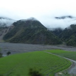
Xueshan is one of the two tallest peaks on Taiwan island. The mountain located in the Shei-Pa National Park is over 3,886m in elevation above sea level and is the second highest mountain in Taiwan and in East Asia. It is mostly snowy throughout the year even in summer. The mountain is geographically located on the northern top half of the Taiwan island. The closet city will be Taichung- a short high speed rail ride away from your most likely port of entry into the country- Taoyuan international airport. It is a couple hour drive past rivers, levees and highland villages before reaching the mountain National park entrance.
As the national park is a protected environment, climbers are required to apply for a park entry permit and police mountain entry permit. The park entry permits has a processing lead time of 7–30 days in advance, while the police permit is issued on the spot at the Wuling Farm police station.
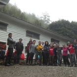
The journey up the summit starts by making the first step into the National park grounds at Shei-Pa visitor center. It is a large wooden log house where the park rangers reside and listen out on communications. Water serving the facilities and toilets here are collected fresh from rainfall via outdoor catching ponds located adjacent to the log house.
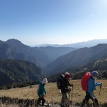
The journey to the peak is a 10.9 km upward trek, which does not seem far by running standards, but tough comprising mostly off-road through trails, ice, snow with increasing climb gradient as you get higher. The actual route meanders on the mountain side and is actually further. My climb spanned over 3 days and 2 nights, with the first 2 days being the primary trek up and the 3rd day the decent. The 1st day was spent at base camp over night at altitude to get everyone acclimatized to the lower oxygen levels (though a 1-2 climbers in my group did get altitude sickness midway). The second day was the summit attempt.
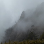
The climb up saw several nice sights, particular a trial running along a mountain side covered in fog. The trekking route is linear and starts off very gently with nice paved concrete steps before disappearing into a forested dirt trail. Most causal visitors at the national park will typically simply just spend their time around the visitor center entrance, while trekkers will usually venture further into the more adventurous forest trails leading up the mountain.
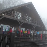
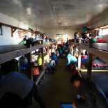
There are two cabins on the summit trail. At the 2.0 km mark is the Qika Cabin, climbers tend to use it as a mid-point rest, water replenishment point and toilet stop before ending their day climb at the 369 Cabin just before sunset. This second, 369 Cabin, is at the 6.9 km mark. All cabins on the mountains are very basic; you must bring your own lights, sleeping and cooking gear. The hut itself comprises of two bunk wings, each with rows of double decker bunks on both sides of the room. The walls of the room is thinly insulated, temperatures are below freezing outside and averaged about 5 C indoors overnight, so you have to sleep-in with thick clothing in an insulative sleeping bag. There is also no water, power or cellphone reception up here in the mountains too, a perfect place to disconnect from technology.
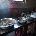
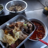
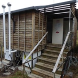
There were several other climbing groups in the hut during my visit, groups will take turns via a roster to vacate the sleeping bunks before the next group arrives, as such the Cabin is usually never empty especially during peak climbing periods. Cooking facilities is simply just a room with table tops and you have to bring your own food, water and fuel for meals. Toilets and shower facilities are located at an adjacent outdoor outhouse and uses sawdust to flush the toilets.
Many of the mountain guides originate from the native aboriginal tribes. They usually have a more rugged and tanned complexion than typical Taiwanese locals, almost with the “Mongolian” look. My trekking group of 20 hired a couple of them from the adventure company for local knowledge, who trekked up the mountain with us and help with the rations and water load to service our rest hut in the mountain, which was low on water. These mountain guides work with other trekking teams presently up in the mountains to check supplies in the need of replenishment, which they will bring in addition to our regular trekking gear.
Panorama inside the Dark Forest of Xueshan
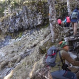
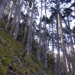
The main limiting factor in scaling up Xueshan is daylight. The feat to summit Xueshan have to done between the opening of day light, as the entry and exit to the summit involves running through a forest known as the “Dark forest” which as the name suggests from its over canopies get pitch black dark in the night, which makes it very hazardous to navigate through in the dark, also considering the abundance of several obstacles such as large fallen trees, icy pathways, all by the sides steep forested slope. There are a number of icy run-offs and streams here, which brings melted fresh water down the mountain and is drinkable.
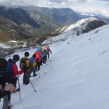
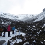
It’s is not long where you start to encounter frost and snow further up the mountain trek where the roads can get really icy. This is where we will usually start the climb with Crampons, but this also means that the final push to the summit is near too. As you are mostly above the clouds, there are minimal disruptions caused by weather. The mountain has a large clearance and opening just before the final push up the summit, which also serves as an emergency helicopter evacuation point.
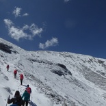
From there, the gradient is steep and mountain surface is covered in deep snow, which makes the climb more energy consuming given the additional need to dig your feet into the deeper, more compact snow and ice to get a foothold before embarking on your next step- which could be your last. When I was there, the trekker speaks of incidents of climbers slipping off and rolling off the slope to certain death right where we were climbing. The risk of Avalanches is real but highly unlikely. The air does get noticeably thinner high up as you have to take in more breaths of air than usual to keep at your required exercise intensity to climb at your set steady pace. The gradient of the climb gets much steeper as you near the summit, at times, even with trekking sticks you have to climb up on all fours to get over an obstacle.
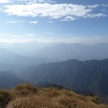
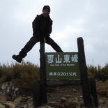
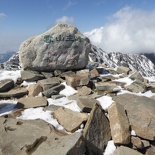
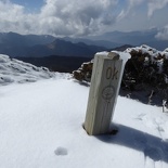
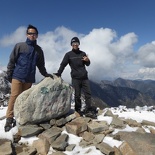
The summit of the Xueshan overlooks all, even every single adjacent mountain within view. You sit above the clouds with the deep clear blue sky above you, which makes sun protection big a necessity up here. A ice-blown tablet bearing the characters “XueShan” sits at the summit clearing, together with an official height marker at the top of the mountain congratulating you on your successful climb up. Take a moment to appreciate the views.
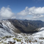
Panoramic view of Xueshan from the summit.
It’s a sight to enjoy only for a moment before making our trek back down again. Descending on icy grounds is in-fact more hazardous than trekking up, as your momentum on your downward foot strike tends to be stronger especially with all the heavy equipment you are carrying. Also, you use vastly different muscle groups, with more emphasis on your quadriceps on the slippery downhill portions as you stabilize for each downhill step. On the uphill climb, you tend to use more of your hamstrings, calves, gluts, which grants more stability especially carrying larger loads. So it pays to strengthen these muscle groups prior to your climb.
Summiting involves a 10km trek forward and back, and it was sunset on our return to the 369 hut. We spent our last night on the mountain in 369 hut, before completing the final decent back to ground level at first light the next morning.
In all, Xueshan is a largely manageable climb in all. It ranks on the scale of easy-medium due to predictable climbing conditions and presence of good climbing support. Definitely a trip worth looking into if you are into for an above-average difficulty mountain climb within a stone-throw away from Singapore.
View more photos of my Xueshan climb here.




Hi Shaun, I’m from Malaysia. Am wondering whether do you know how to get to Shei-Pa National park and the trailhead of Xueshan from Taichung?