Along the way back to Hue from the Ancient Village of Phuoc Tich, I stopped by Ben Hai River demilitarized zone (DMZ). It is one of the few controversial conflict zones during the North-South Vietnam war. Located in the Vĩnh Linh District, Quảng Trị Province, this DMZ was the location of the 17th Parallel. Historically this is where the Geneva Accords of 1954 demarcated the country into two. It set the boundaries bisecting the US-controlled South Vietnam to the communist North Vietnam.
Ben Hai river River
The Ben Hai river runs a nearly 100km across Vietnam. The widest river gap can reach a width over 200m. Moreover, the narrowest point bridging the North and South about 20 meters apart here.
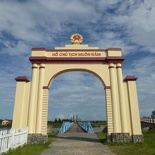
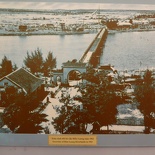
This said boundary here by the river separated the North and South Vietnam about 5 km from either side of the river. This spot is the closest point where the North and South meet, spanned by the notorious Hien Luong Bridge. Today, the bridge and the archway are gazetted as major national monument for the reunification of Vietnam at the end of the Vietnam War.
DMZ flag pole
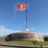
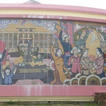
The formidable 35 meter tall flag pole structure with a solid concrete base greets you at the site on the Northern side. Lined around it the walls of the flag pole structure are mosaic murals depicting scenes of the communist life. On close inspection, it tells of a story decorated complete with scenes of men, women and children in country building for the communist country.
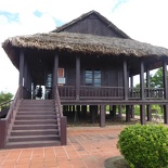
Tucked by the flag pole is a small ticketing counter, as well as a small provision store and toilets. The tickets grant you access to the small exhibition hut by the flag pole as well as a museum across the road.
Hien Luong Bridge DMZ zone
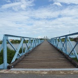
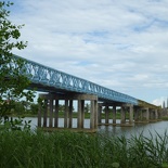
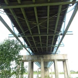
Stories speak of Hien Luong bridge being destroyed and rebuilt several times during the war, mainly by shelling and bombing. Since the bridge was constructed in 1922, it had been rebuilt over 8 times. Moreover, Hien Luong Bridge also took the state of many colours over its lifetime, with US-Saigon side in conflict with the communist north in the choice of differentiating and unifying the colours on both sides of the bridge.
Currently standing today is a bridge replica of what Hien Luong bridge was and as originally built by the French. Moreover, this new bridge is being built as close to what it was during the active war periods. It was recreated with the exact look, materials and style from records. Fine details includes the differing and eccentric half-colour paint scheme on each span of the bridge. Emphasizing the constant disagreements from both ends.
This colour matching story tells of a cat-and-mouse game between both sides highlighting the desire to demarcate and unify the different sides of the bridge. The replica bridge accurately captures this exact sentiment.
The bridge today is a pedestrian-only bridge, though it was upgraded at some point during the war to allow light vehicles to cross. The bridge also now runs parallel and next to modern vehicular bridge serving part of the main arterial road here.
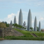
You can walk across Hien Luong bridge from one side of the river to the other. Leading to a memorial park honoring the lives lost of women and children during the war.
Panorama of the Hien Luong bridge from North side
Audio Propaganda Towers
There is an old guard tower on the Southern side. Stories speak that sometimes both sides can be so friendly that it is possible for both sides to talk to each other, some days, they will shoot people across the river on sight. This conflict is well told though a museum on the Northern side, featuring a number of photographs and scenes of the war, as well as loud speakers riddled by bullet holes.
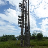
Moreover, during the war, audio from the communist north were played via tower-mounted loud speakers blasted over to the south side. The west countered this by erecting their own across the river too. Hilariously, there were sayings that the American loudspeakers were louder and far more superior to that of the communist north, so the nothing gets heard from them. These American towers though never survived following the North’s subsequent invasion.
Given heavy American bombing during the war, many unexploded bombs still lay within the vicinity. Most of the unexploded bombs at the site here were already cleared up by international ordance groups, before being opened up as a tourist site by the Vietnanese government. However, there is no telling what else still lurks still buried under the grounds here.
Vietnamese Demilitarized Zone Museum
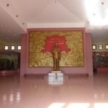
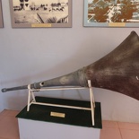
Sitting on the north side is a single floored pink museum building with a large open courtyard up front. The building entrance is flanked by two tower loudspeakers previously used on the tall towers which blasted propaganda on either sides. The museum leads into an open room with a small guestbook table by the side.
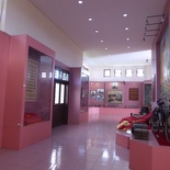
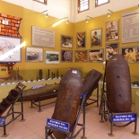
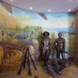
Standing in front and facing the museum front door is a statue of Ho Chi Minh himself. Lined along the walls of the museum are various framed photos, documents and artifacts of the Vietnam -American war conflict. Stashed in a corner of the museum are lines of neutralized aircraft bombs and artillery shells used in the war. These empty bombs were excavated and made safe for display within the museum itself.
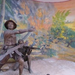
On the far end of the museum are several wall-painted murals depicting the bravery of the Vietcong who fought during the war. Showcased here too are the war efforts contributed by female soldiers on the front battle lines. Additionally, there are displays of several modes of transportation used by the soldiers. This includes the use of trusty bicycles which brought many of their riders to the front lines.
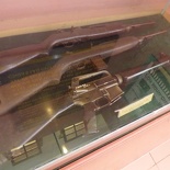
Several Russian assaults rifles such as the poplar AK-47– from the Soviet Union and Warsaw Pact countries, mortar grenade tubes as well as American M16 rifles left behind after the war were also on display in various display cabinets.
Photos of the Vietnamese war efforts
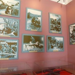
Lined on the pink walls of the museum are several black and white photographs of people involved with the war effort on both sides. Undeniably, the displays have a sense of a biasness against the Americans- the atrocities captured and immortalized behind glass.
Interesting photos includes those involved in digging and constructing the extensive Vietcong underground tunnel network. These tunnels are otherwise known as the Cu Chi Tunnels. It links the region all the way back to Saigon. Furthermore, there are photos showing the extensive damage and pock-marked war landscape over the Vietnamese landscape. These were made courtesy of American carpet bombing.
A recommended route will be starting with a walk from the main flag pole, towards Ben Hai River looking across the river. Thereafter, you take a path under the Hien Luong bridge before climbing back up onto the archway and doing the museum last. You are good for the DMZ for under an hour.
Till today, the bridge is still a solemn place indeed, on the history of war, a symbol of division in the country showing the loss, separation and hurt during the war.
Lastly, view more photos of Vietnamese Demilitarized Zone.

